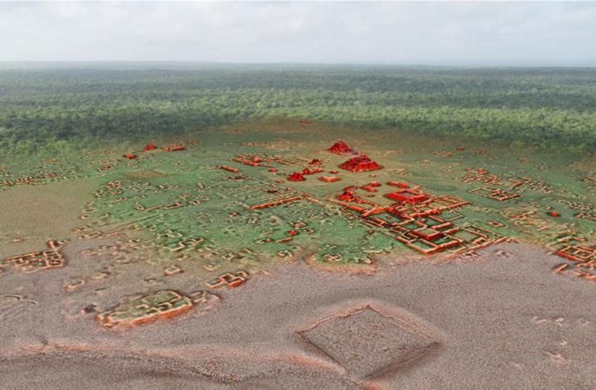
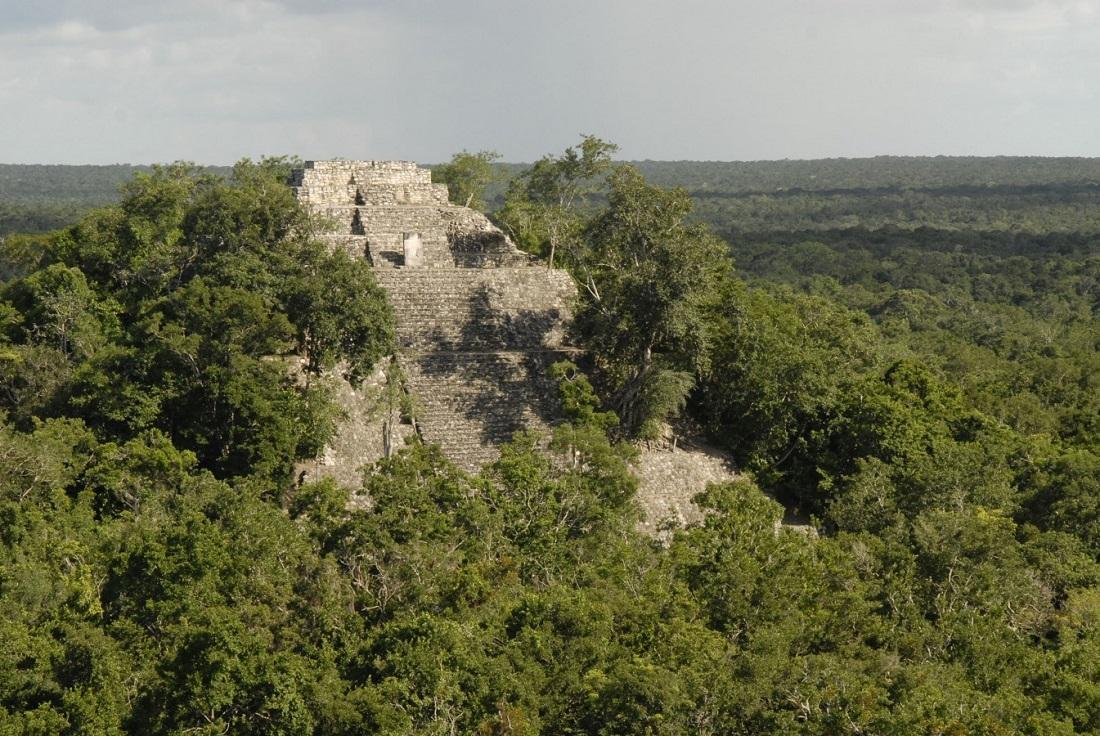
A LIDAR survey of the Maya archaeological zone of Calakmul by researchers from the National Institute of Anthropology and History (INAH) and the Bajo Laberinto Archaeological Project has revealed the extent of urban expansion that lies beneath the jungle Canopy.

Calakmul is located in the Mexican state of Campeche, deep in the forests of the greater Petén Basin region. The city was the capital of the Kingdom of the Snake, indicated by the widespread distribution of snake head glyphs known as “Kaan.”
Throughout the Classic Period, the city was an intense rivalry with the major polity of Tikal to the south. It is claimed that at its height in the Late Classic period, the city had 50,000 residents and covered an area of more than 70 square kilometers.
LIDAR (light detection and ranging) is a remote sensing method that uses light in the form of a pulsed laser. The light pulses and combines with other data collected by the airborne system to generate precise, three-dimensional information on the Earth’s shape and surface features.

INAH researchers conducted this aerial LiDAR study over a 95-square-kilometer area in collaboration with the National Centre for Airborne Laser Mapping at the University of Houston, Texas, and Aerotecnologia Digital SA de CV.
“It’s just a game changer,” said Kathryn Reese-Taylor, an anthropology and archeology professor at the University of Calgary, in an interview with The Canadian Press.
“You can be trying to survey and to map sites in the rainforest, and what would take you years to accomplish, LIDAR can do in a couple of days of flying over these large areas.”
The findings revealed dense urban sprawl and residential apartment complexes made up of 60 different structures organized around temples, sanctuaries, and possibly trade and commerce plazas or markets.


