A new high-resolution digital map of Roman roads, called Itiner-e, is providing the most detailed picture yet of the Empire’s vast transportation network as it existed around 150 CE. Published in Scientific Data, the dataset almost doubles the previously known length of roads, now totaling 299,171 kilometers across almost four million square kilometers, up from a previous estimate of 188,555 kilometers.
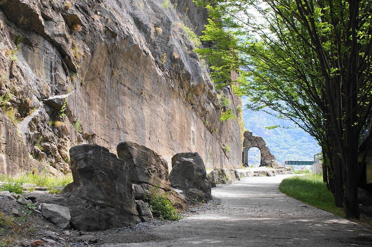
At its height in the second century CE, the Roman Empire stretched from Britain in modern-day Europe to Egypt and Syria in Africa and Western Asia, with over 55 million inhabitants. Its extensive road network was vital for administration, trade, military logistics, and cultural exchange. Despite centuries of research, however, the network has never been completely mapped, and earlier digitizations have lacked high resolution.
Itiner-e was developed by Tom Brughmans, Pau de Soto, Adam Pažout, and their colleagues by combining archaeological and historical sources with modern and historical topographic maps, satellite imagery, and remote sensing.
The roads were divided into 14,769 segments by the researchers. Of those total segments, 103,478 kilometers (34.6%) were classified as main roads, while 195,693 kilometers (65.4%) were classified as secondary routes. Crucially, only 2.7% of the locations of all roads are known with certainty; nearly 90% are less precisely located, and about 7.4% are hypothesized based on historical and geographic inference.
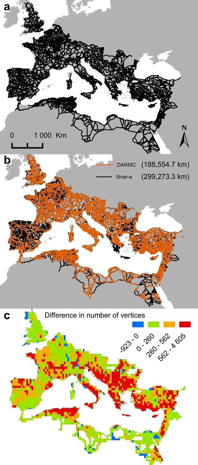
The dataset gives particular importance to previously underrepresented regions, such as the Iberian Peninsula, Greece, and North Africa, and allows for improved spatial accuracy by adapting routes to natural geography—for example, allowing mountain crossings to follow winding paths rather than straight lines.


Researchers say Itiner-e provides a transformative resource for the study of the Empire’s mobility and will help scholars investigate how roads shaped connectivity, trade, migration, administration, and even the spread of diseases.
Although this dataset represents the most comprehensive open-source mapping of Roman roads to date, the researchers say it cannot yet capture changes in the network over time. They stress that Itiner-e not only consolidates existing knowledge but also exposes gaps in our understanding, pointing toward future studies on the evolution of the Empire’s infrastructure and its role in shaping the ancient world.


Disclaimer: This website is a science-focused magazine that welcomes both academic and non-academic audiences. Comments are written by users and may include personal opinions or unverified claims. They do not necessarily reflect the views of our editorial team or rely on scientific evidence.
Comment Policy: We kindly ask all commenters to engage respectfully. Comments that contain offensive, insulting, degrading, discriminatory, or racist content will be automatically removed.