In the southern Peruvian Andes, a long band of thousands of carefully carved holes at a high altitude has perplexed researchers for nearly a century. Monte Sierpe—also sometimes called the “Band of Holes”—stretches along a ridge above the Pisco Valley for about 1.5 kilometers. About 5,200 circular depressions, each up to 2 meters wide and about a meter deep, are arranged in ordered rows, clustered into blocks. For decades, it has been the subject of speculation, and its purpose is still uncertain. New research now hints that this unusual landscape feature may have served as a local system for trade, storage, and record-keeping during the late pre-Hispanic era.
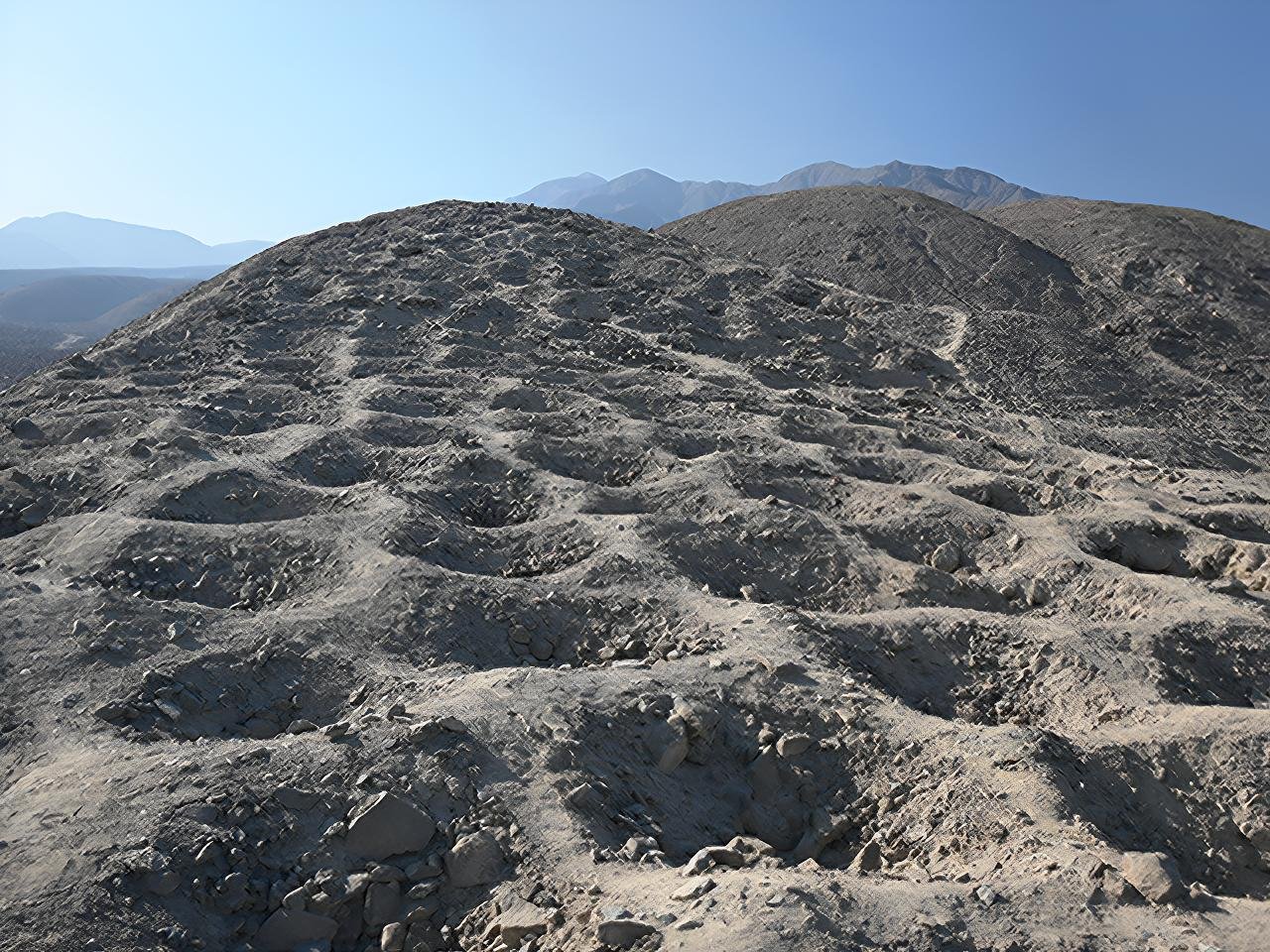
The study, published in the journal Antiquity, combines high-resolution drone mapping with microscopic analysis of sediments taken from the holes. These methods allowed researchers to detect subtle patterning in how the holes were arranged, revealing that the blocks were not random or decorative, but appear to reflect a structured system of grouping and counting. The layout shows parallels to khipus, the knotted-cord recording devices used widely across the Andes for administrative and accounting purposes.
This interpretation fits the regional history. Monte Sierpe lies within the heartland of the Chincha Kingdom, a powerful coastal polity that flourished between CE 1000 and 1400. Chincha rule encompassed some of the densest agricultural landscapes, maritime trade networks, and specialized craft production. Their territory supported a population of more than 100,000, including farmers, fisherfolk, and merchants who moved goods between coastal and highland regions. The position of the site along pre-Hispanic roads and close to a defensive settlement would have provided a convenient location for transactions, redistribution, and the movement of supplies.
Sediment samples recovered from several of the holes contained pollen from maize and bulrush, two plants strongly associated with daily life and economic exchange in the region. Because maize is a crop that does not spread its pollen over long distances naturally, the grains found in the holes were likely placed there intentionally rather than being wind-deposited. Bulrush was commonly used to make baskets, indicating that goods may have been transported or temporarily stored in woven containers. Such evidence suggests that the holes were periodically lined and filled with goods, perhaps during market gatherings or tribute deliveries.
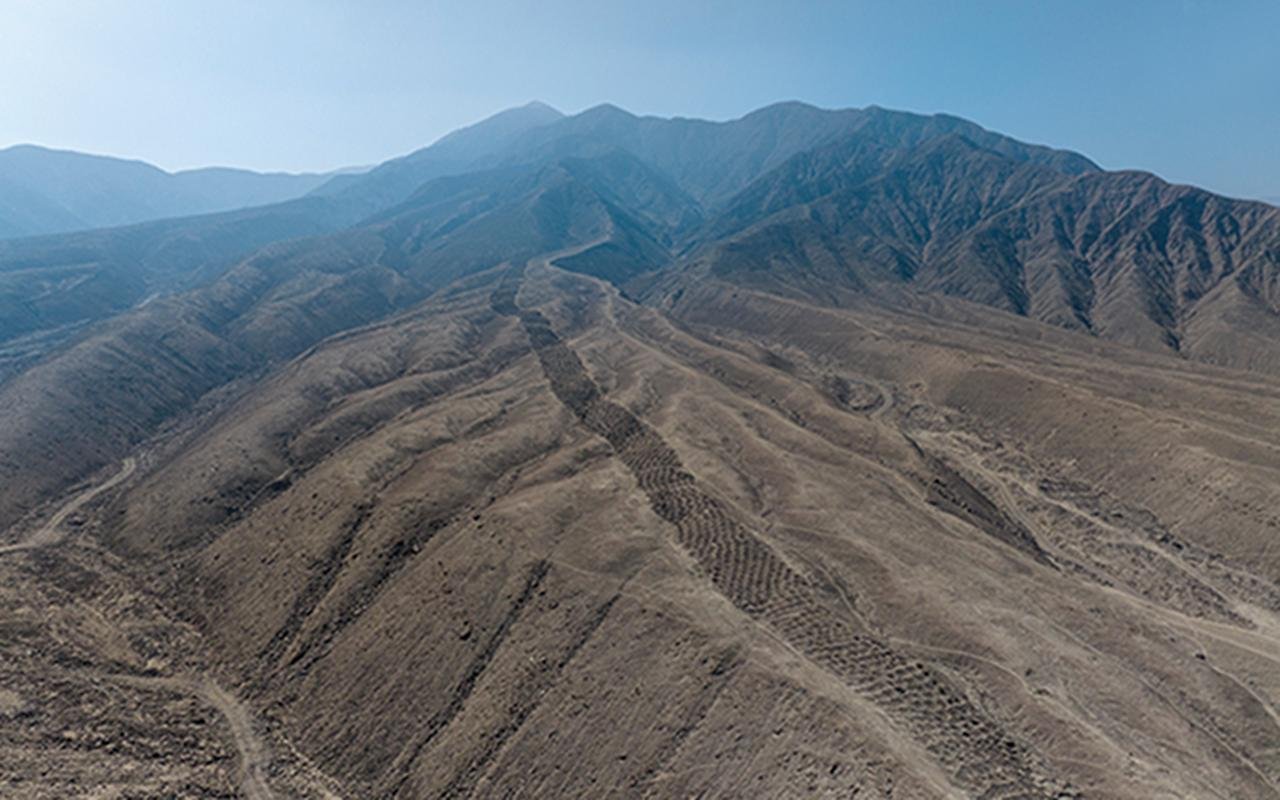
Monte Sierpe may have assumed a new administrative role when the Chincha Kingdom was incorporated into the expanding Inca Empire in the fifteenth century. The Incas are best known for their labor and resource management based on complex systems of census and taxation. The slight differences recorded in the number of holes across the blocks could reflect different contribution levels from the communities located nearby.
Monte Sierpe has variously attracted scientific interest and sensational speculation over the years, including claims that the holes were linked to ancient astronauts. The authors of the new study stress that grounding the site in its local cultural and historical context is crucial. Rather than a mysterious enigma, Monte Sierpe appears to represent a creative Indigenous solution for organizing economic life in a complex and interconnected society.
The results indicate how communities shaped the landscape for cooperation and exchange long before the arrival of Europeans. They also point toward the diversity of accounting systems in the Andes, where memory, labor, movement, and material goods were coordinated without written scripts. Further excavation, dating, and comparison with surviving khipus may help clarify how this remarkable site functioned in practice and how it changed under Inca rule.





Comments 0