Archaeologists have identified the first confirmed Roman marching camps in Saxony-Anhalt, marking the earliest structural proof of Roman military movement deep into the interior of Germania near the Elbe River. The sites lie between the northern Harz Mountains and the Elbe and represent the northeasternmost Roman camps known in Germania Libera.
The State Office for Heritage Management and Archaeology of Saxony-Anhalt led the research with strong support from volunteer heritage specialists. Teams relied on satellite imagery, aerial photography, geophysical surveys, and targeted excavation. Earlier evidence from the region consisted of scattered coins and iron hobnails from legionary sandals. Such finds suggested troop movement but offered no proof of organized military infrastructure.
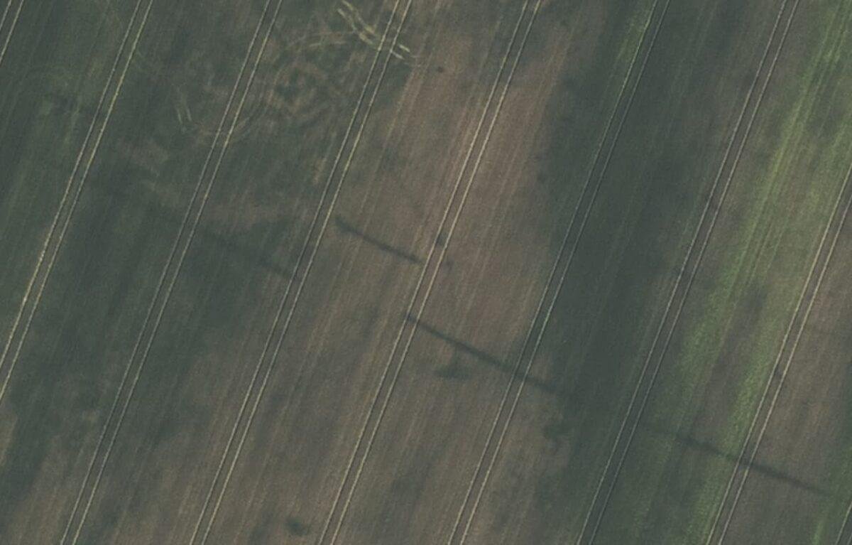
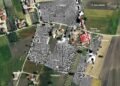
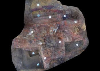
Roman marching camps followed a strict design. Each camp formed a rectangular enclosure with rounded corners, straight ditches, and ramparts. Entrances secured by a forward-placed ditch segment placed in front of the gate, known as a titulum. Two main streets crossed at the center, where the headquarters stood. Aerial images revealed these features with enough clarity to separate Roman camps from prehistoric structures in the same landscape.
Historical sources describe Roman advances toward the Elbe beginning in 13 or 12 BCE during the reign of Augustus. Generals such as Drusus, Ahenobarbus, and Tiberius led campaigns aimed at turning Germania into a Roman province. The defeat of Varus in 9 CE ended this effort, and Roman forces withdrew west of the Rhine. Later centuries saw limited written references to renewed incursions, especially during the third century CE, though physical confirmation remained absent.
The current discoveries fill this gap. The first site emerged in 2020 near Aken, where satellite images showed straight ditches and a corner with Roman proportions. Aerial surveys confirmed a gate protected by a titulum. Additional camps appeared near Trabitz and Deersheim through analysis of digital orthophotos between 2023 and 2024. Each site displayed consistent dimensions and rounded corners typical of Roman military planning.
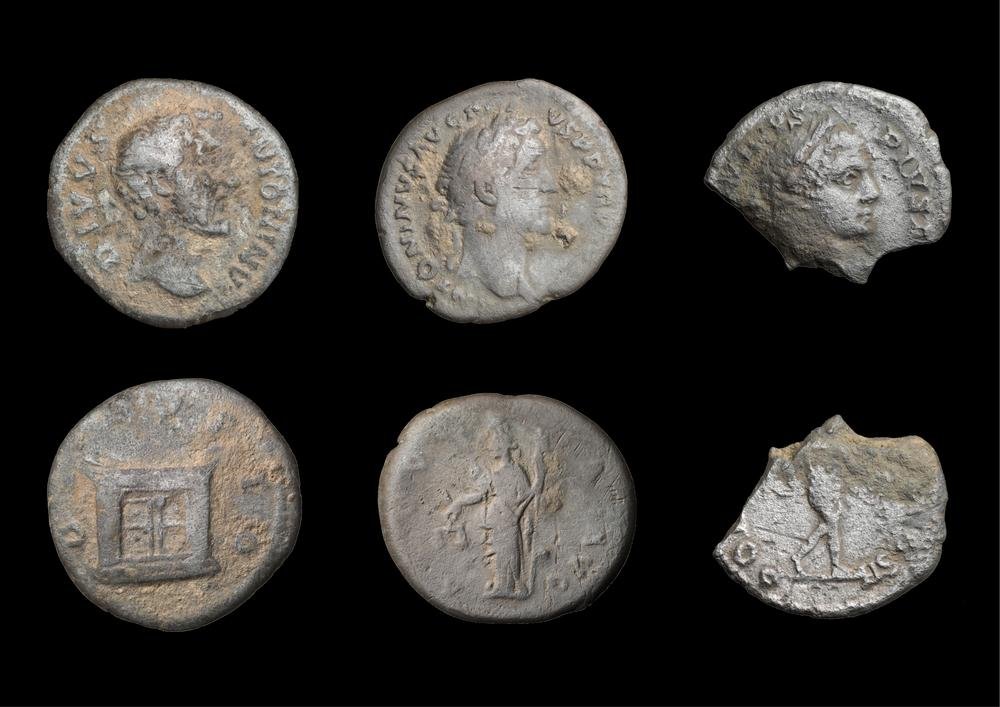
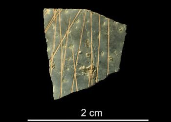
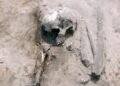
Field verification followed. Volunteers and archaeologists conducted systematic surface surveys and metal detection. More than 1,500 objects came to light, mostly iron nails and rivets linked to military equipment. Fibula fragments and coins supported chronological assessment. Geophysical measurements mapped complete layouts at Deersheim and confirmed key elements at Trabitz.
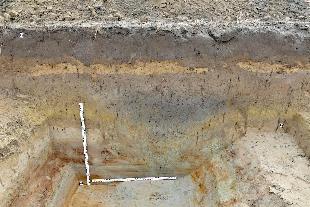
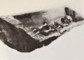
Excavations during 2024 and 2025 exposed V-shaped defensive ditches. At Aken and Trabitz, ditch widths ranged from 1.7 to 1.8 meters with depths exceeding one meter. Radiocarbon dates and coin evidence point to the early third century CE. A denarius of Caracalla found at Trabitz supports a link to campaigns around CE 213.
These camps push the known extent of Roman operations several dozen kilometers northeast of previous assumptions. The evidence shows organized troop movement and temporary occupation far beyond the frontier zone. The findings reshape understanding of Roman strategy in central Germany during a period often viewed as defensive rather than expansive.
More information: State Office for Heritage Management and Archaeology (LDA) Saxony-Anhalt


Disclaimer: This website is a science-focused magazine that welcomes both academic and non-academic audiences. Comments are written by users and may include personal opinions or unverified claims. They do not necessarily reflect the views of our editorial team or rely on scientific evidence.
Comment Policy: We kindly ask all commenters to engage respectfully. Comments that contain offensive, insulting, degrading, discriminatory, or racist content will be automatically removed.