A groundbreaking archaeological study has determined that the renowned Carnac stone alignments in Brittany, France, may be one of Europe’s oldest megalithic landscapes, dating back to ca. 4600 BCE. The findings are the result of a French–Swedish research collaboration under the NEOSEA project, funded by the European Research Council (ERC) and led by archaeologist Dr. Bettina Schulz Paulsson from the University of Gothenburg.
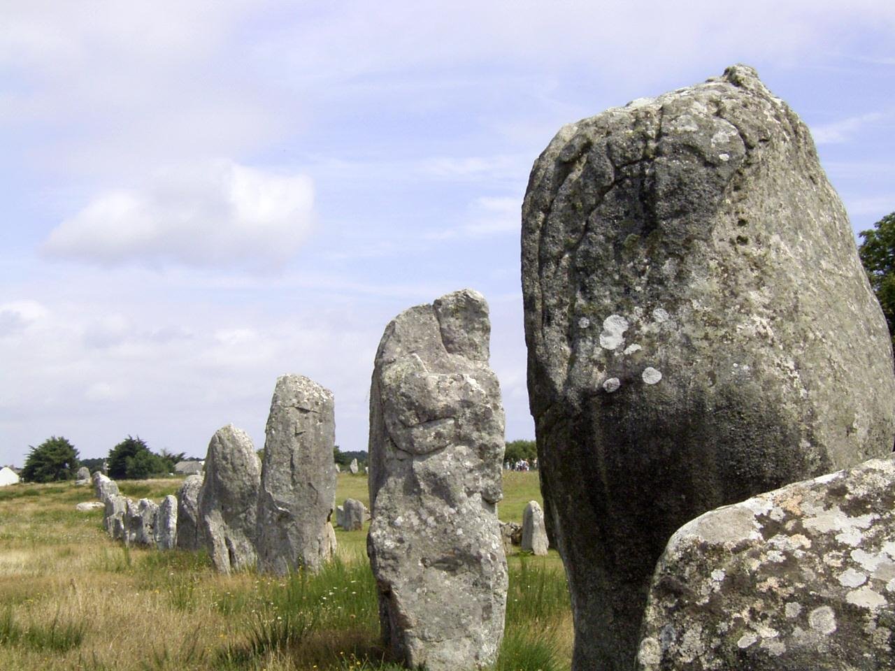
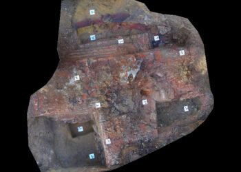
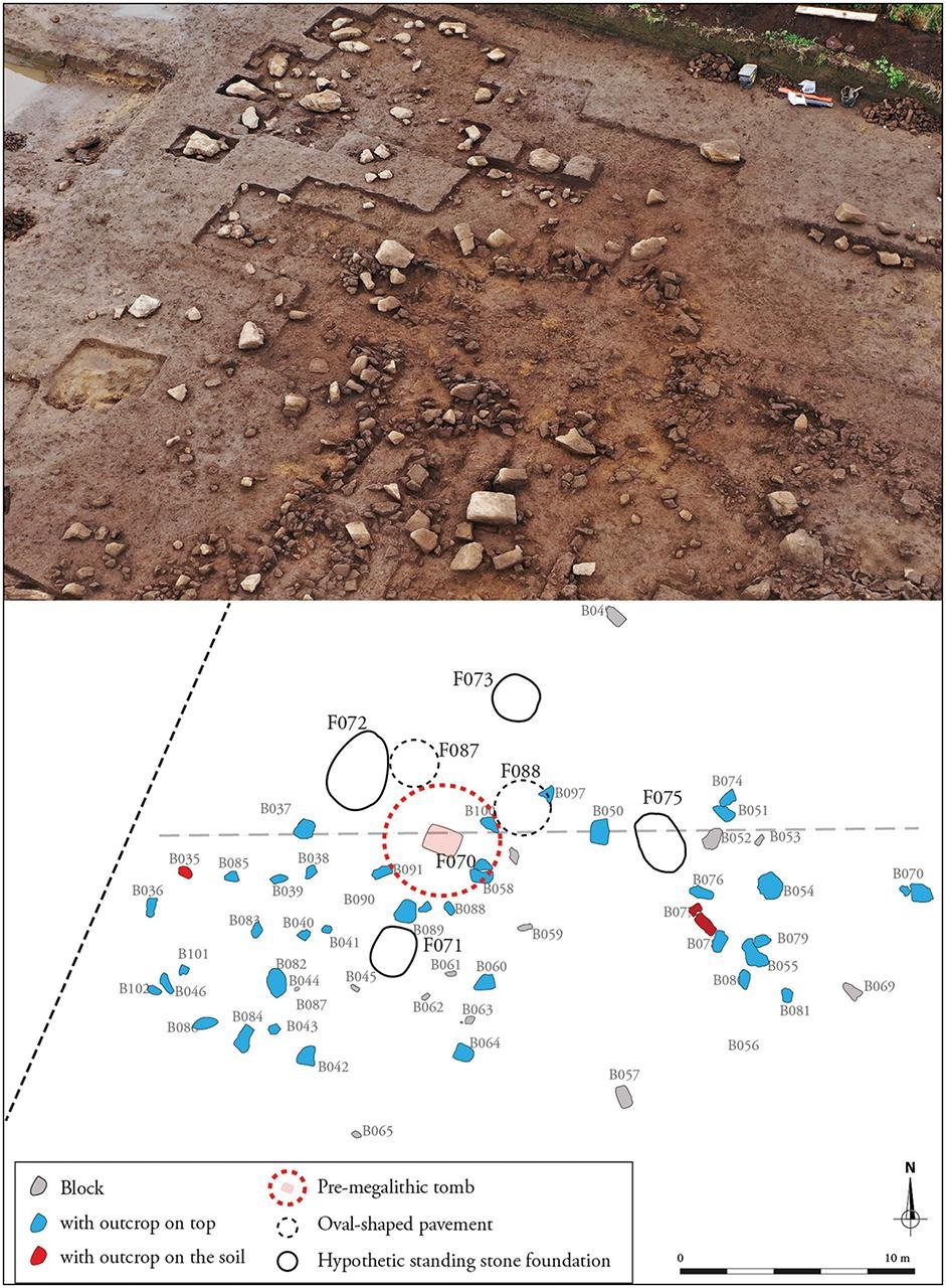
Extending for 10 kilometers along the coastline between Carnac and Erdeven, over 3,000 standing stones have puzzled scholars for centuries with their linear and curvilinear alignments, which differ from the circular ones at Stonehenge. Now, new excavations of a recently discovered section of the site called Le Plasker, at Plouharnel, have provided new information on the chronology and development of this complex monumental landscape.
The researchers, from the University of Gothenburg, the French excavation company Archeodunum, and the University of Nantes, carried out systematic sampling and radiocarbon dating of material that was revealed during rescue excavations at Le Plasker. Archeodunum excavation leader and NEOSEA researcher Audrey Blanchard led the excavations. The results, published in the journal Antiquity, were enhanced through the use of Bayesian statistical modeling, which allowed for highly precise dating.
“We were able to reconstruct the site’s history with unprecedented chronological precision,” said Schulz Paulsson. Nearly 50 radiocarbon samples, as well as sediment and charcoal analyses, indicated that the upright stone alignments were erected between 4600 and 4300 BCE. That makes the Bay of Morbihan—where Carnac is located—Europe’s oldest known megalithic region, even predating the British Isles’ famous stone circles.
Most intriguingly, the stone alignments were also found alongside fire pits and hearths. While the function of these fire features is unclear, their presence suggests a potential link between the construction of the megaliths and communal fire-based activities such as cooking or ritual feasting.


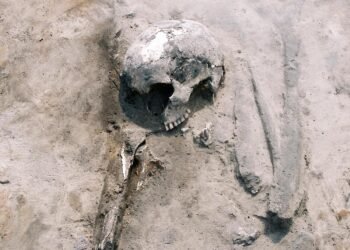
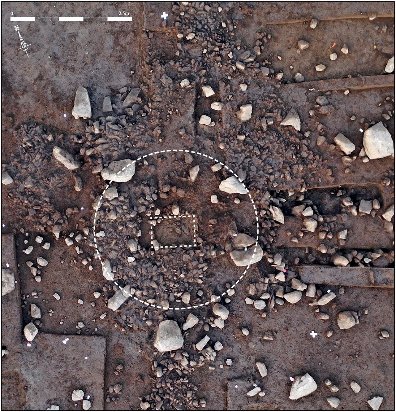
Archaeologists also unearthed a monumental tomb beneath the megalithic levels, dating to around 4720 BCE. Built directly on top of a Mesolithic hunter-gatherer hut, the tomb likely represents one of the earliest examples of monumental funerary architecture in northwest France.

Though many of the stones have been removed—either prehistorically or in later periods—their foundation pits have remained, preserving the original layout of the alignment. Curiously, the stones had a consistent north-northwest to south-southeast orientation across the periods, a detail that archaeologists believe indicates deliberate and symbolic design choices.
Despite this significant progress, the precise purpose of the Carnac alignments remains an open question. Were they territorial markers? Ceremonial routes? Astronomical tools? What is clear is that this was a dynamic, living landscape.
The discovery of Le Plasker and the specific dating of the Carnac alignments not only reshape the record of Neolithic monument-building in Europe, but also position the Bay of Morbihan as a cradle of early megalithic culture—a tradition that would eventually spread across the continent.