In the Dehloran plain in southwest Iran, archaeologists have uncovered a brick inscribed with Akkadian script, along with intricately patterned bricks, suggesting their likely connection to an ancient irrigation system in the region.
The findings, presented during a specialized session organized by the Institute of Archaeology and reported by ISNA, provide valuable insights into the political and economic significance of the ancient site of Garan, situated on the western border of Elamite civilization.

Garan, covering 17 hectares in the Dehloran Valley, features a conical elevation in the south surrounded by irregular mounds. Mohsen Zeinivand, an archaeologist involved in the excavation, emphasized Garan’s exceptional importance in archaeological studies, spanning from the late ancient periods to the end of the historical era. The site transformed into the largest settlement from the second millennium BCE until the late Achaemenid period.
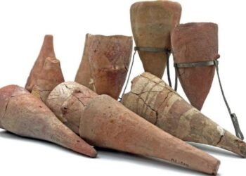
The recent discovery includes an Akkadian-inscribed brick, accompanied by intricately patterned bricks. Surface surveys identified numerous broken bricks with possible inscriptions, with one sample revealing partially readable words such as ‘ruler,’ ‘son,’ and ‘his lord,’ suggesting the use of the Akkadian language.
Zeinivand explained that the lines on the patterned bricks represent four distinct features: a river, a mountain, a dam or embankment, and irrigation channels. This discovery hints at the existence of a water supply system in Garan during the Elamite period.
The Elamites, named by the Akkadians and Sumerians, referred to themselves as Haltami, meaning “those of the high country.” The term ‘Elam’ translates to “highlands” or “high country,” encompassing settlements on the Iranian Plateau from the southern plains to the Zagros Mountains.
Susa, the former capital of the Elamite Empire, played a crucial role throughout the late prehistoric periods, closely tied culturally to Mesopotamia. The influence of the Akkadian dynasty led the Elamites to adopt the Sumero-Akkadian cuneiform script.
Frank Hole, Kent Flannery, James Neely, and Henry Wright, conducted archaeological work in the Deh Luran plain nearly 50 years ago. In 2016 and 2019, the area was resurveyed. The recent survey on Garan Mound unveiled two inscribed objects, providing information on the economic and political importance of Tappeh Garan in the Old Elamite Period.
The Akkadian scripts and geometric patterns found at Garan, believed to illustrate an agricultural scheme, reinforce the historical value of the site. Grooves on the brick represent elements like a river, a mountain, a dam, and irrigation channels, resembling Mesopotamian geographical plans from the second and first millennium BCE.
Dr. Mohsen Zeinivand and his team affirm that the findings indicate a major irrigation project during the Elamite period in Garan. The geographical plans found on the bricks align with Mesopotamian construction and planning techniques.
The uncovered channels at the site confirm the effectiveness of the irrigation system, transporting water from the Dovir River to the farmlands of Garan and Musian. Located strategically on the border between Elam and Iraq, Garan served as a crucial point on the route between Susa and Assyria.
Dr. Zeinivand concludes that these new findings solidify Garan’s pivotal role as a major political-economic center in ancient western Iran under Elamite rule.


