
Archaeologists studying the ancient fortress of Argishtikhinili in Armenia’s Araks Valley have identified more than 1,000 kilometers of water-management features across the landscape, including over 134 kilometers of channels that could trace back to the kingdom of Urartu. The findings offer a new look at how one of the ancient Near East’s lesser-known states transformed a dry plain into productive farmland.
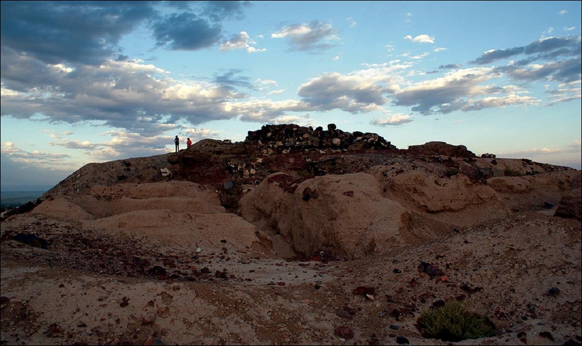
Argishtikhinili, one of the major urban centers of Urartu, stood near present-day Armavir in western Armenia. The site once extended across roughly 3.5 kilometers, making it one of the country’s largest archaeological complexes. Although the surrounding Araks Valley is fertile, farming depended on irrigation. Researchers argue that large-scale water control in this region began under Urartian rule.
The fortress was founded during the reign of King Argishti I, who ruled from 786 to 764 BCE. Built between two natural rises topped by citadels, the settlement held both political and religious importance. Ancient inscriptions tied to the city’s foundation describe a network of five irrigation channels supplying water to urban districts, agricultural fields, gardens, and vineyards.
One stone inscription states that the area had previously lain uncultivated. Researchers view this as a sign that limited water access prevented earlier settlement. Archaeological surveys support that picture, as they have found no evidence for habitation before the Urartian period.
What happened to the irrigation system after Urartu’s collapse around 590 BCE has been harder to trace. Irrigation appears to have returned during the Hellenistic era, when Armavir regained prominence. Some later canals could reuse older routes. The region stayed occupied into the medieval period, and modern agriculture reshaped the landscape again with canals, pumping stations, and pipelines layered over older infrastructure.
RelatedStories

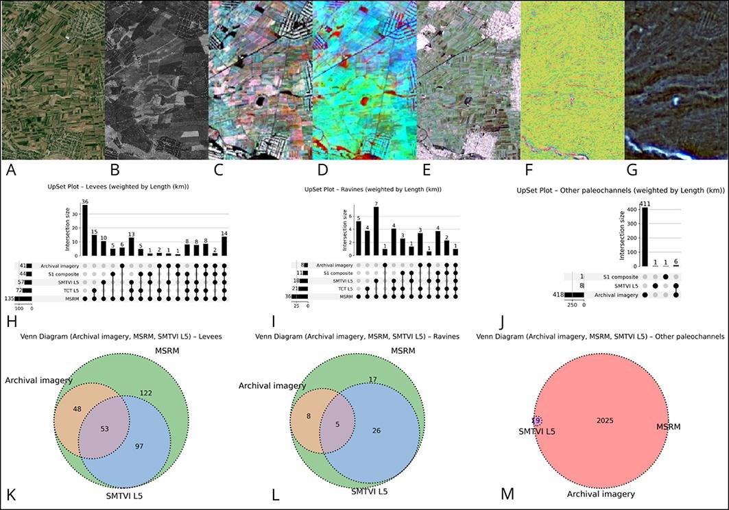
To search for traces of ancient water systems, the research team combined fieldwork with remote sensing methods. Work around Argishtikhinili began in 2013 and later expanded westward. The study drew on a wide set of data sources, including Landsat 5 satellite imagery, Sentinel-1 radar data, declassified American CORONA and GAMBIT spy satellite photographs, and digital elevation models.
The older satellite photographs proved especially useful because they captured the area before many modern agricultural changes altered the terrain. Researchers processed seasonal vegetation data, radar imagery, and elevation models to detect faint traces in soil color, vegetation growth, and landform relief. They then mapped potential features using GIS software.
The survey recorded 1019.05 kilometers of water-related landscape features. These included modern canals, former river and stream beds, ancient levees, and palaeochannels, which are abandoned or buried waterways.
Modern irrigation channels made up about 428.9 kilometers of the mapped system. Former mountain streams and old branches of the Araks River accounted for another 419.6 kilometers. The team also identified 36 kilometers of deeply incised palaeochannels and 134.6 kilometers of possible ancient canals concentrated around Argishtikhinili.
Researchers distinguished two main forms of palaeochannels. Some appeared as ravine-like cuts visible in terrain models. Others emerged through changes in vegetation or soil coloration. Nearly all of these suspected ancient channels matched patterns visible in GAMBIT satellite imagery, strengthening confidence in the mapping results.
The terrain east of Argishtikhinili revealed winding levees that may represent crevasse splays formed by shifting branches of the Araks River. Straight canal segments in the same area likely reflect later agricultural modifications. The landscape itself added further challenges. River migration, tectonic activity, low gradients, and mechanized farming have altered or erased subtle traces of older irrigation systems.
Even so, the researchers argue that the Araks Valley around Argishtikhinili preserves an unusual record of long-term water management. Many of the mapped levees follow a north-east orientation, hinting at links to dried stream beds or larger hydraulic systems that may have drawn water from the Araks River.
The study does not claim that every identified canal belongs to the Urartian period. Some channels were likely built or modified centuries later. Dating these features with greater precision will require more archaeological work and closer study of nearby settlements.
The new mapping still points to one clear pattern. Intensive irrigation shaped the agricultural history of the Ararat Plain over many centuries. If future research confirms the age of the suspected canals, Argishtikhinili would stand as one of the clearest examples of how Urartian rulers used engineered water systems to support cities, farming, and political control in the South Caucasus.











Disclaimer: This website is a science-focused magazine that welcomes both academic and non-academic audiences. Comments are written by users and may include personal opinions or unverified claims. They do not necessarily reflect the views of our editorial team or rely on scientific evidence.
Comment Policy: We kindly ask all commenters to engage respectfully. Comments that contain offensive, insulting, degrading, discriminatory, or racist content will be automatically removed.