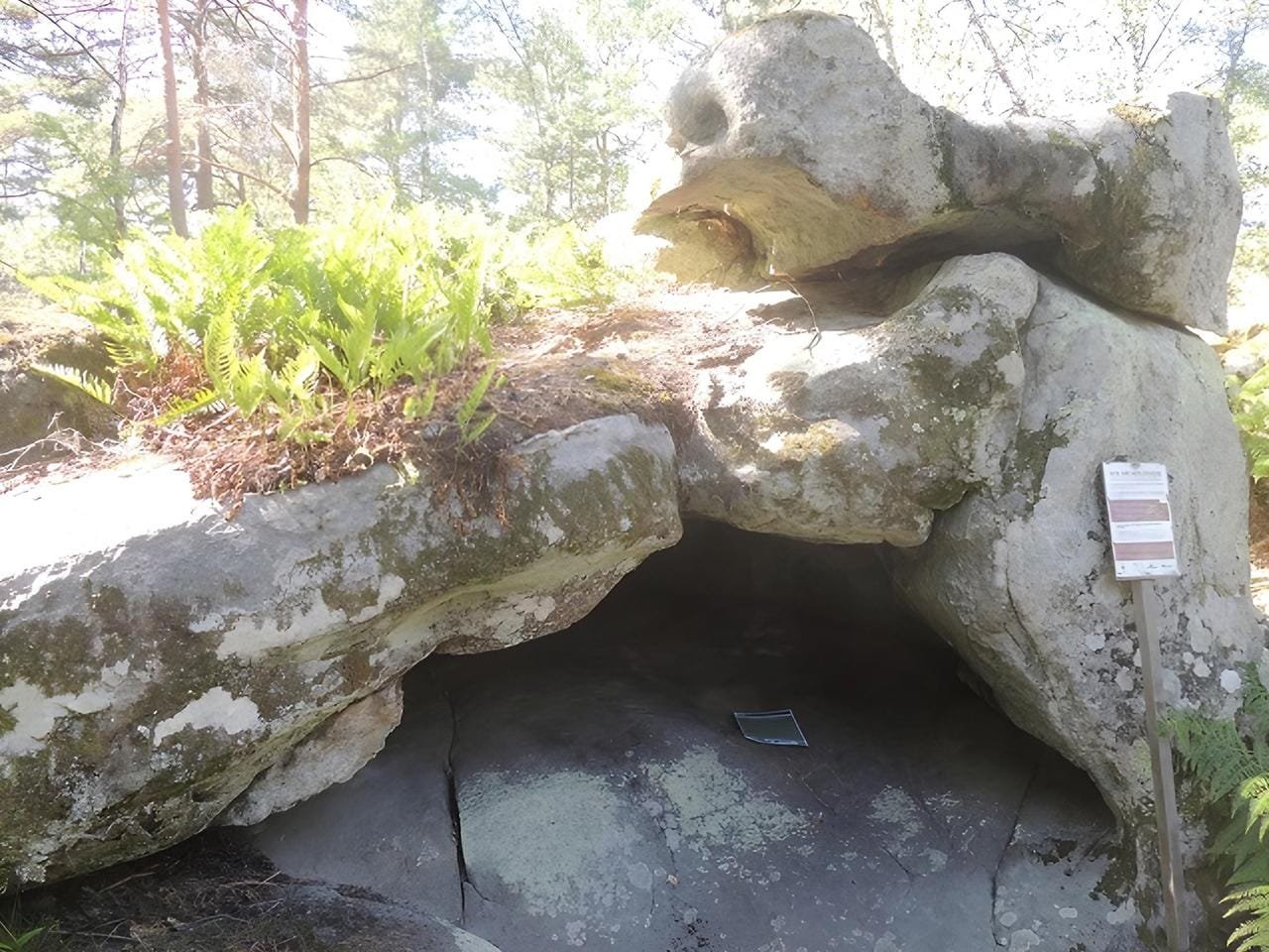
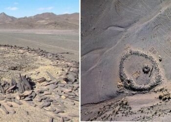
Researchers in France have discovered what might be the oldest 3D map ever found. They spotted it in a sandstone cave called Ségognole 3, which sits south of Paris. This amazing carving, thought to be from the Upper Paleolithic era about 20,000 years ago, sheds light on how smart and advanced early hunter-gatherer groups were.
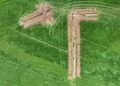
The study, carried out by Dr. Médard Thiry from MINES Paris Center of Geosciences and Dr. Anthony Milnes from the University of Adelaide, was published not long ago in the Oxford Journal of Archaeology. Their work points to the carvings being a small-scale version of the Noisy-sur-École landscape showing off the region’s natural features and hydrographic systems.
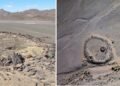
Ségognole 3 is unique among the sandstone formations in the region, which feature over 2,000 examples of Stone Age carvings. This cave blends artistic, symbolic, and practical aspects in a remarkable manner. The engravings include lifelike images of horses and a vulva-shaped opening, along with a small-scale intricate depiction of the surrounding landscape.
“The engraved floor is not quite a map, but more like a miniature model of the surrounding landscape, potentially a world-first 3D model of a Palaeolithic territory,” the researchers wrote in the article.
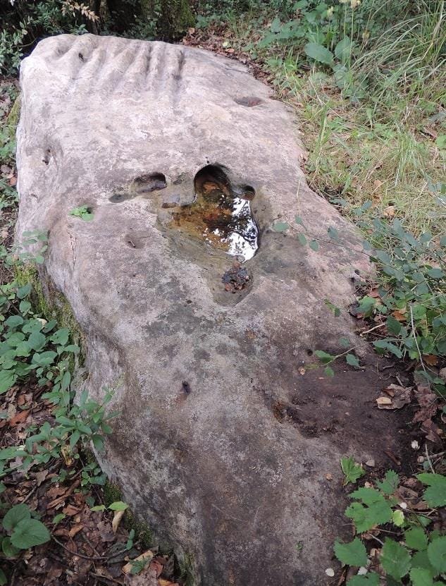
The cave’s design cleverly integrates natural features with human modifications. Channels, basins, and depressions carved into the floor guide rainwater through the cave, creating a dynamic depiction of rivers, deltas, and hills when the water flows. These carvings appear to mimic the École River valley, situated upstream of the Seine River.
The cave’s layout blends natural elements with human-made changes. Grooves, pools, and hollows cut into the ground direct rainwater through the cave, creating a lively picture of rivers, deltas, and hills as the water moves. These cuts seem to copy the École River valley, which sits upstream from the Seine River.
The researchers noted how the water flow brings the carvings to life, showing a clear picture of the area’s water system. “The accuracy of the drawing of this hydrographical network reveals a remarkable capacity for abstract thinking in those who drew it and in those for whom it was intended,” they wrote in their published paper.
Beyond its artistic value, the discovery has an impact on our understanding of Upper Paleolithic communities’ advanced thinking skills. The engravings, which combine beauty with practicality, show a deep grasp of space and the environment.
“This find shows that Paleolithic peoples were capable of imaginative abstract thinking, in addition to being excellent observers,” the researchers said.
The Ségognole engraving might have had several uses, such as planning hunts, teaching community members, or performing water-related rituals. The cave’s location, with a view of a valley rich in resources and migrating plant-eaters, supports the hypothesis that the engravings served a practical purpose for the community.
While rudimentary landscape engravings have been found in other parts of Europe, the Ségognole map stands out for its three-dimensional execution and integration of natural features.


Disclaimer: This website is a science-focused magazine that welcomes both academic and non-academic audiences. Comments are written by users and may include personal opinions or unverified claims. They do not necessarily reflect the views of our editorial team or rely on scientific evidence.
Comment Policy: We kindly ask all commenters to engage respectfully. Comments that contain offensive, insulting, degrading, discriminatory, or racist content will be automatically removed.
Got photos?
Asking for people who can see.